
Samseonggung (삼성궁)
15.5Km 2024-02-21
86-15 Samseonggung-gil, Cheongam-myeon, Hadong-gun, Gyeongsangnam-do
Samseonggung is a Taoist shrine located at 850 meters above sea level on Jirisan Mountain. It serves as a spiritual hub for practicing Sinseondo, embodying traditional Korean culture. In 1983, Kang Min-ju (Taoist Priest Hanpul), along with his disciples, restored the sodo, a sacred altar from the Gojoseon period. This shrine stands as a revered sanctuary, honoring the primal ancestors of the Korean people: Hwanin (Lord of Heaven), Hwanung (Supreme Divine Regent), and Dangun (legendary founder of Gojoseon).
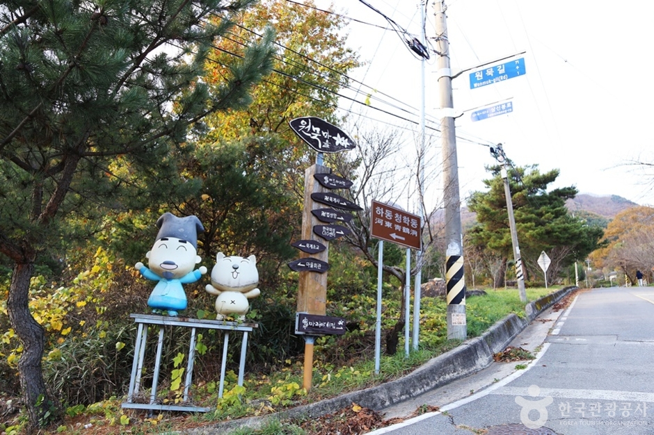
Cheonghak-dong Etiquette School Seonbi Seodang (청학동예절학교 선비서당)
15.8Km 2024-03-04
60-10 Wonmuk-gil, Cheongam-myeon, Hadong-gun, Gyeongsangnam-do
Cheonghak-dong, located at the foot of the ridge facing Hadong on Jirisan Mountain, is a village inhabited by 200 residents from thirty families. It hosts several seodangs (village schools), among which Seonbi Seodang stands out for its educational programs focusing on etiquette, character development, and Chinese characters. Additionally, the village offers a variety of experience programs, including traditional culture, farming activities, and perseverance training.
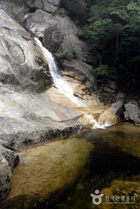
Guryonggyegok Valley (구룡계곡)
16.2Km 2024-04-07
Guryongpokpo-gil, Namwon-si, Jeonbuk-do
+82-55-972-1000
Guryonggyegok Valley, a 3 kilometer-long valley in the northern part of the Jirisan National Park, located in Namwon, Jeollabuk-do, is just the place to enjoy a panoramic view of the unusually shaped rocks and precipitous cliffs. Under the Guryongpokpo Falls, located at the peak of the valley, is a small pond called, ‘Yongso’ (meaning ‘dragon pond’). Legend has it that a dragon lived here before it ascended to heaven. Visitors can tour the valley by driving along the skyway, an extension of the tourist road of Jirisan Mountain, or take an invigorating hike up a mountain by taking the Jeongnyeongchigan route, which extends along the valley to Baemsagol Valley(Banseon) and Nogodan Peak.
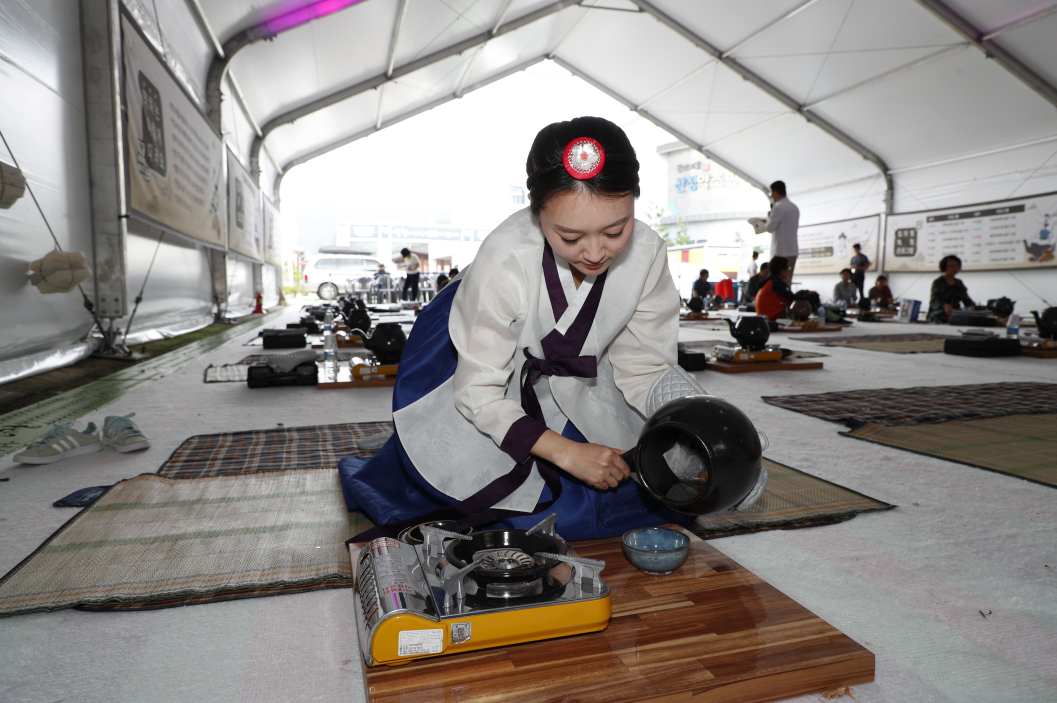
Sancheong Medicinal Herb Festival (산청한방약초축제)
16.3Km 2025-07-11
61 Donguibogam-ro 555beon-gil, Geumseo-myeon, Sancheong-gun, Gyeongsangnam-do
+82-55-970-6670
The Sancheong Herbal Medicinal Festival is a celebration for those interested in traditional herbal medicine. Donguibogam (Principles and Practice of Eastern Medicine) and its author, Heo Jun, are highly regarded in Korean medicine. Sancheong, where Heo Jun studied, is home to Jirisan Mountain, which is often seen as a treasure trove by Korean medicine doctors due to being a habitat of over 1,000 species of medicinal herbs. The festival features Korean medicine clinics offering treatments like acupuncture, while the festival square is transformed into an herbal garden with photo zones, tea drinking spots, spaces for making herbal flower pots, and exhibitions and sales of herbal flower pot goods. Visitors can also participate in making herbal sweet rice puffs, nostalgic herbal dalgona candy, herbal cocktails, and herbal tea brewed in a large decoction pot.
◎ Dongui bogam
Dongui bogam is a medical encyclopedia completed in 1610, written by Heo Jun after a meticulous study and observation of medical books and practices of China and Joseon. It is considered the best medical encyclopedia in the East and was registered as a UNESCO Memory of the World in 2009.
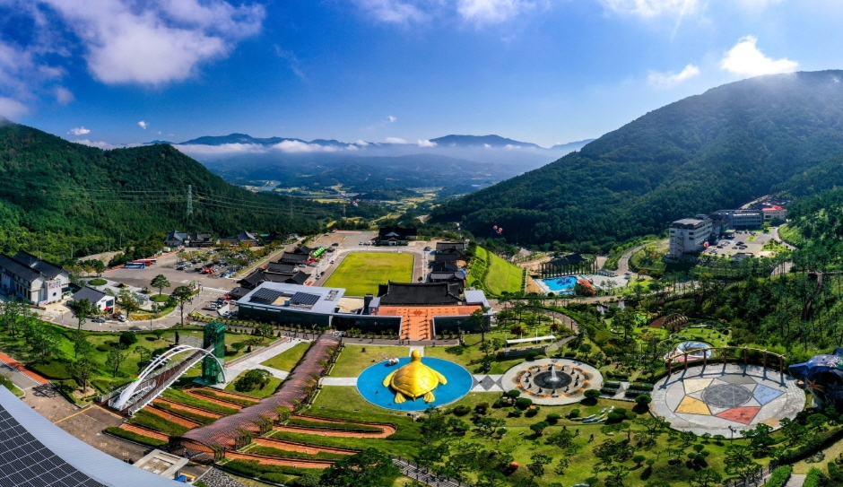
Sancheong Donguibogam Village (산청 동의보감촌)
16.4Km 2025-10-27
45-6, Donguibogam-ro 555beon-gil, Geumseo-myeon, Sancheong-gun, Gyeongsangnam-do
Enjoy various traditional Korean medicine in one place!
Sancheong Donguibogam Village is home to the Museum of Sancheong Korean Medicine, Korea's first traditional Korean medicine-themed museum created in 2007; the Korean Medicine Theme Park; the Sancheong Medicinal Herb Hall; the 'Ki' Experience Hall; the Korean Medicine Recreational Forest and the Korean medical clinics. The village allows you to experience 'healing' moments through traditional medicine. Here, you can learn diverse knowledge about traditional Korean medicine, organized by Heo Jun, the author of Donguibogam (medical encyclopedia). If you are suffering from chronic stress, look no further than Sancheong Donguibogam Village.
Hadong Tea Cultural Center (하동야생차문화센터)
16.6Km 2025-10-23
571-25, Ssanggye-ro, Hwagae-myeon, Hadong-gun, Gyeongsangnam-do
The Experience Hall of the Hadong Tea Museum is located in Unsu-ri, Hwagae-myeon, Hadong-gun, Gyeongsangnam-do. This annex of the museum is dedicated to hands-on programs. Main programs include a tea ceremony, a tea snack session (three-colored, sesame, and bean varieties), green tea seed accessory making, tea-leaf dyeing, make-your-own matcha class, tea-leaf picking, tea roasting, and a Doncha (compressed tea) experience.
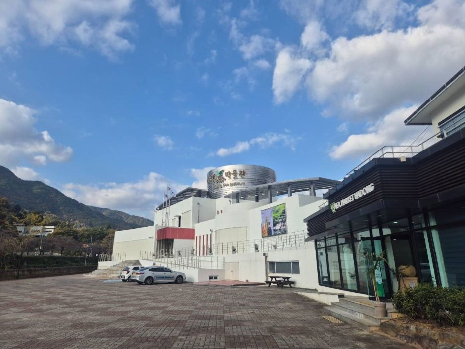
Hadong Tea Museum (하동야생차박물관)
16.7Km 2022-08-05
571-25, Ssanggye-ro, Hadong-gun, Gyeongsangnam-do
+82-55-880-2956
The Hadong Tea Museum is located at the foot of Jirisan Mountain in Hadong, Gyeongsangnam-do. It aims to promote the tea culture of the area, the first tea producer in the nation, while advertising the quality and superiority of Hadong green tea. The center is located adjacent to the tea farming area and Ssanggyesa Temple, one of the most famous tourist attractions in Korea.
The museum features an exhibition hall explaining the history and culture associated with Korean tea, and an experience hall where visitors can enjoy hands-on programs like making tea and learning traditional tea etiquette, as well as a shop selling high-quality tea produced in the region. Every year, the museum also hosts the Hadong Wild Tea & Culture Festival every year.
Sangnim Park (상림공원)
17.1Km 2021-11-24
49, Pilbongsan-gil, Hamyang-gun, Gyeongsangnam-do
+82-55-960-5756
Hamyang is well known for its beautiful mountains and clean waters. Sangnim Park, located in Hamyang-gun, Gyeongsangnam-do, has beautiful sceneries throughout the year as well as various attractions including pavilions, memorial plaques, walking trails and more. The park was formed during the Unified Silla period, providing deep history as well as a place to relax.
Piagolgyegok Valley (피아골계곡)
17.3Km 2024-02-02
Piagol-ro, Gurye-gun, Jeollanam-do
+82-61-780-7700
Piagolgyegok Valley is located in Jirisan Mountain between Nogodan and Banyabong Peaks. The name of the valley comes from the crimson red maple leaves that fill the valley in fall. It is also one of the ten most beautiful highlights of Jirisan Mountain. The valley is famous for its fall colors, but it is also a beautiful place to visit all year around, from azaleas in spring to snow-covered rocks in winter.
Near the entrance to Piagolgyegok Valley is the largest temple in Jirisan Mountain, Yeongoksa Temple, and national treasures. The valley is not steep, providing an easy walk for all visitors. The trail stretches 6 kilometers from the ticket booth, and passes many beautiful places like Yeonjudam and Samhongso Pond. At the end of the valley, the trail continues another 2 kilometers up a steep hillside to reach Imgeollyeong Pass.
Dosimdawon (도심다원)
17.5Km 2025-10-23
51-2 Sinchondosim-gil, Hadong-gun, Gyeongsangnam-do
Hadong's tea fields, which are known as the thousand-year-old tea fields, are characterized by being wild rather than cultivated. Among the many tea gardens in Hadong, the one with the most beautiful and peaceful scenery is Dosimdawon. In “House on Wheels,” actor and singer Yim Si-wan and Girls' Generation Yoona sat in a pavilion and sipped green tea while looking out at the green tea fields stretched out below. Tea utensils and tea leaves in a picnic basket are available for rent so that you can brew your own tea.
 English
 한국어
한국어 日本語
日本語 中文(简体)
 Deutsch
 Français
 Español
 Русский