
Jirisan National Park (Namwon) (지리산국립공원(남원))
8.0Km 21790 2024-04-07
255 Jeongnyeongchi-ro, Jucheon-myeon, Namwon-si, Jeonbuk-do
+82-63-630-8900
Jirisan National Park is the second-highest mountain in South Korea, standing at an elevation of 1,915 meters, spanning across the provinces of Gyeongsang-do and Jeolla-do. Revered as a sacred mountain alongside North Korea's Baekdusan Mountain, it is home to the Asiatic Black Bear and features numerous peaks, including Cheonwangbong Peak. In spring, various flowers such as Royal Azalea bloom, while lush forests thrive in summer, vibrant foliage adorns the landscape in autumn, and the winter scenery boasts snow-covered peaks and icy landscapes.
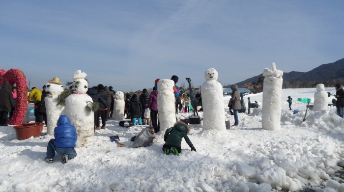
Jirisan Namwon Baraebong Snowflake Festival (지리산남원 바래봉 눈꽃축제)
8.9Km 25548 2024-04-07
214, Baraebong-gil, Namwon-si, Jeonbuk-do
• 1330 Travel Hotline: +82-2-1330
(Korean, English, Japanese, Chinese) • For more info: +82-63-635-0301
Jirisan Namwon Baraebong Snowflake Festival is held in Herb Valley and the nearby Baraebong Peak area in Namwon-si, Jeollabuk-do. Organized by Unbong Aehyang Committee, the festival features a variety of winter activities including ice and snow sledding, making snowmen, snowball fights and more. Unbong Herb Valley boasts spectacular snow-covered fields due to its high altitude that keeps the snow from melting.
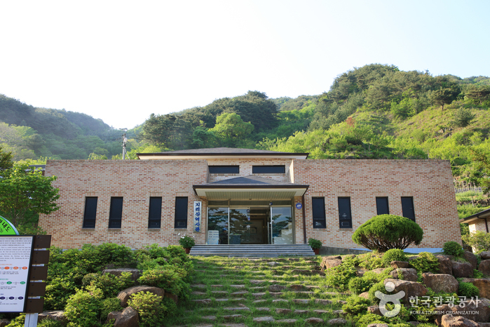
Jirisan History Museum (지리산역사관)
9.4Km 45200 2021-06-15
1438, Hwagae-ro, Hadong-gun, Gyeongsangnam-do
+82-55-880-2954
Jirisan History Museum is located within Jirisan National Park at the start of the hiking course to Byeoksoryeong Pass. Rather a small museum, it provides detailed information about the history of North Korean partisans and the routes that they took throughout the mountain during the Korean War. The museum also exhibits the war relics, lifestyle of the mountain villagers and local produce of Hadong.
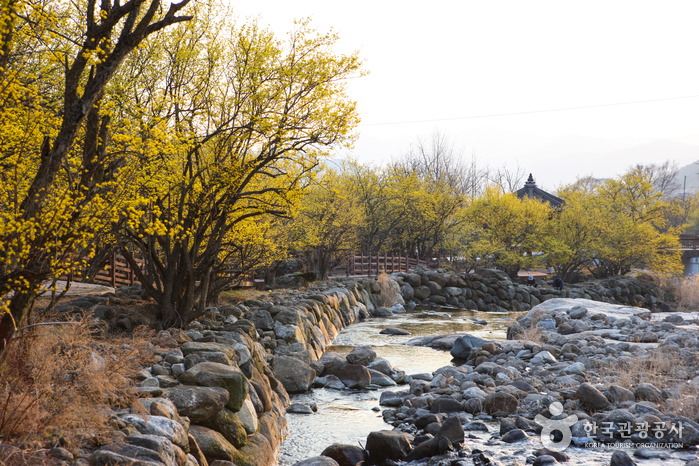
Gurye Sansuyu Village (구례 산수유마을)
10.0Km 23411 2020-04-25
6-12, Wianwolgye-gil, Gurye-gun, Jeollanam-do
+82-61-783-9114
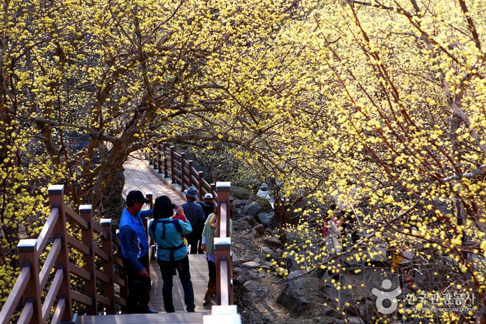
Sandong-myeon in the Gurye-gun region is widely known as the home of sansuyu (cornus fruit) and is responsible for 70% of Korea’s sansuyu fruit production. The Sansuyu Village, located at the foot of the southwest side of Manbokdae Mountain (1,433 meters), is considered the region’s most representative village of sansuyu. The village has a beautiful natural landscape with the snow-covered Jirisan Mountain range to its back and a small valley to its right.
Visitors to the village can wind down at the hot spring complex nearby, which is famous for its germanium content and said to have numerous health benefits. The sansuyu flowers of Sansuyu Village typically are at full bloom between March 20 and March 31, drawing throngs of visitors.
* Please note that blossom dates are not exact and change slightly from year to year.
Seoamjeongsa Temple (서암정사(함양))
10.0Km 43110 2024-02-21
27-79 Gwangjeom-gil, Macheon-myeon, Hamyang-gun, Gyeongsangnam-do
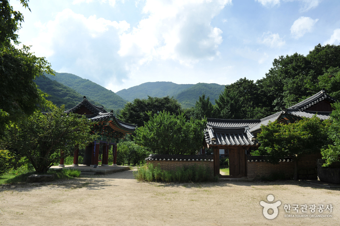
Seoamjeongsa Temple belongs to Byeoksongsa Temple, which is at the entrance of the Chilseongyegok Valley of Jirisan Mountain. Monk Woneung rebuilt Byeoksongsa Temple, which had been damaged during the Korean War in 1950. This hermitage features the Buddha statues Woneung carved into the natural bedrock, a grotto sanctuary with statues of the Pure Land, Daebanggwangmun Gate, and Sajagul Cave.
Guryonggyegok Valley (구룡계곡)
10.4Km 19779 2024-04-07
Guryongpokpo-gil, Namwon-si, Jeonbuk-do
+82-55-972-1000
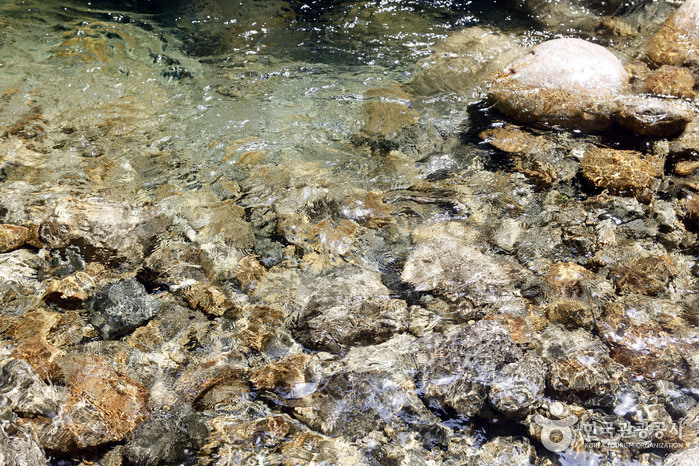
Guryonggyegok Valley, a 3 kilometer-long valley in the northern part of the Jirisan National Park, located in Namwon, Jeollabuk-do, is just the place to enjoy a panoramic view of the unusually shaped rocks and precipitous cliffs. Under the Guryongpokpo Falls, located at the peak of the valley, is a small pond called, ‘Yongso’ (meaning ‘dragon pond’). Legend has it that a dragon lived here before it ascended to heaven. Visitors can tour the valley by driving along the skyway, an extension of the tourist road of Jirisan Mountain, or take an invigorating hike up a mountain by taking the Jeongnyeongchigan route, which extends along the valley to Baemsagol Valley(Banseon) and Nogodan Peak.
![[Jirisan Trail Course] Inwol-Geumgye](http://tong.visitkorea.or.kr/cms/resource/73/1918173_image2_1.jpg)
[Jirisan Trail Course] Inwol-Geumgye
10.8Km 5195 2024-04-06
308-1 Junggun-ri, Inwol-myeon, Namwon-si, Jeonbuk-do
Inwol-Geumgye Trail Course is part of the Jirisan Trail, starting from Inwol-myeon, Namwon-si, Jeollabuk-do, and passing through Deunggujae in Hamyang-gun, Gyeongsangnam-do, before reaching the village of Geumgye. Covering a distance of 20.5 kilometers, completing the trail typically takes around 10 hours, leading many travelers to plan a 1-night, 2-day itinerary. Along the way, hikers can enjoy the majestic landscapes of Jirisan Mountain, vast rice paddies, and visit six mountain villages.
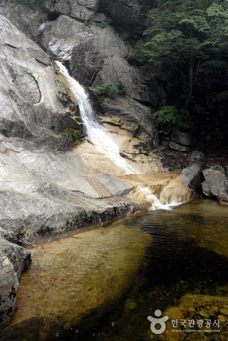
Jirisan Chilseongyegok Valley (칠선계곡(지리산))
11.5Km 34739 2022-07-29
Chuseong-ri, Hamnyang-gun, Gyeongsangnam-do
+82-55-970-1000
Chilseongyegok Valley is the most beautiful valley in Jirisan Mountain, and is one of the top three valleys in the nation, along with Cheonbuldonggyegok Valley in Seoraksan Mountain and Tamnagyegok Valley in Hallasan Mountain. The 16-kilometer valley stretching from Uitan of Macheon-myeon to Cheonwangbong Peak is characterized by very tough topography but beautiful scenery and is the only remaining primeval forest of Jirisan Mountain. It is also dotted with seven waterfalls and 33 ponds. The hike becomes more difficult as the trail enters the valley. Because the valley has taken many lives, some people call it "The Valley of Death." For that reason, visitors must apply in advance and hike with a guide. The trail in Chilseon Valley is a 9.4-kilometer course from Chuseong Village in Macheon-myeon to Cheonwangbong Peak, which does not follow the natural valley, due to the valley's steep and dangerous features. Starting from Chuseong Village, the trail passes Yongso Pond, Jujiteo Site, Chuseongmang Rock, Seonnyeotang Pond, Ongnyeotang Pond, Biseondam, Chilseonpokpo Falls, Daeryukpokpo Falls, Samcheungpokpo Falls and Mapokpo Falls, all before reaching Cheonwangbong Peak.
Gurye Sansuyu Festival (구례산수유꽃축제)
11.8Km 42473 2024-02-27
45 Sanggwan 1-gil, Gurye-gun, Jeollanam-do
+82-10-2079-4546
Gurye Sansuyu Festival is an annual spring flower festival. Major programs include exhibition of local products made from sansuyu (cornus fruit), while other programs include traditional music and dance performances, experience programs, and fireworks.
Gurye Yeongoksa Temple (연곡사 (구례))
12.0Km 26862 2021-02-09
774, Piagol-ro, Gurye-gun, Jeollanam-do
+82-61-782-7412
Yeongoksa Temple is located in Naedong-ri, Gurye-gun and was constructed in 543 by Yeongi, a high Buddhist monk, who also helped create Hwaeomsa Temple. The temple was destroyed during the Imjin War (1592-1598) and the Korean War. In spite of the damage, the temple has continued to house two national treasures and four treasures. Starting from March 1, 1981 with the original Beopdang Hall, the temple began to be rebuilt due to the efforts of the leading monk at the time, Chang Sungbu.
Acording to legend, Yeongi discovered a pond in the current sanctuary area when reading about the land's topography. While he was looking at the middle of the pond, one swallow flew from a whirlpool. After that, the pond began to dry up and the place was then used for the temple. As such, the name Yeongok refers to the phenomenon of "Yeon," a swallow, and "Gok," a valley. There is a memorial plaque for Go Gwang-sun, a patriotic leader who fought against Japanese power during the Japanese colonization period while taking shelter at Yeongoksa Temple
 English
 한국어
한국어 日本語
日本語 中文(简体)
 Deutsch
 Français
 Español
 Русский