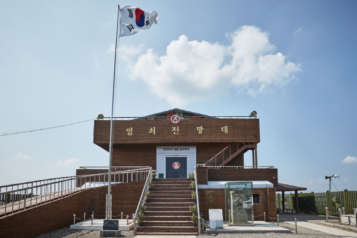
Key Observatory (열쇠전망대)
18.3Km 2022-09-07
1375-1, Dongnae-ro, Yeoncheon-gun, Gyeonggi-do
+82-31-839-2147
Called to play the role of an important key for unification, Key Observatory was established on April 11, 1998 to commemorate the sorrow of homesickness and provide security education in the area. Military in the area can also keep watch over the north from this location. Visitors can see the DMZ fences and the Guard Point as well as exhibition hall where war items can be found.
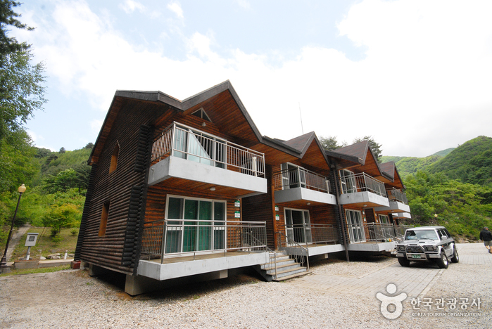
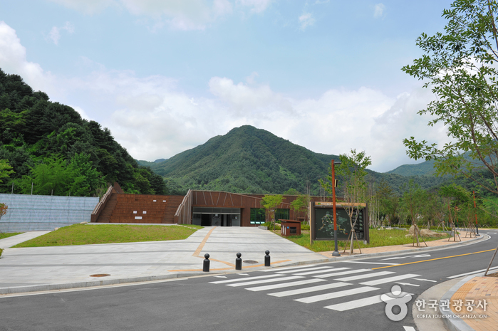
Bokjusan National Recreational Forest (국립 복주산자연휴양림)
18.3Km 2021-06-07
818, Haojae-ro, Cheorwon-gun, Gangwon-do
+82-33-458-9426
Bokjusan National Recreational Forest was officially designated as a national recreational forest in 1998. It is a home to a wide variety of flora and fauna, as well as numerous recreational facilities including two hiking routes (2.5 ㎞ and 1.5 ㎞) to the Bokjusan Mountain summit, Forest Recreation Center equipped with 10 guest rooms, and a campground.
Just 15 minutes by car from the forest is Maewoldae, where Joseon dynasty scholar and author Kim Si-Seup lived in seclusion. Maewoldae is surrounded by a lush forest with a deep valley, and also offers a magnificent view of Seonampokpo Falls at the foot of the mountain standing across. At the entrance of Maewoldae is the Cheongseokgol Outdoor Studio, where popular Korean TV dramas such as "Im KkokJong (1996)" and "Damo (2003)" were filmed.
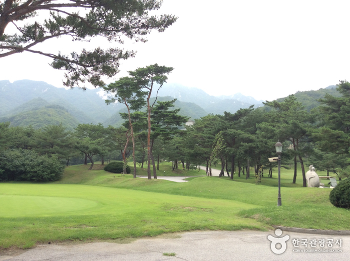
Sun Hill Golf Club (썬힐 골프클럽)
19.4Km 2022-08-25
809, Unakcheonggye-ro, Gapyeong-gun, Gyeonggi-do
+82-31-585-7900
Located halfway up Unaksan Mountain, also known as the small Seoraksan of Gyeonggi-do, Sun Hill Golf Club has four beautifully designed courses (Sun, Valley, Pine and Hill courses with 9 holes each) that combine to give a total of 36 holes and a 9-hole Par 3 golf course. The golf resort boasts of the best quality green fields and beautiful natural scenery all throughout the year. The Sun Course and the Valley Course offer golfers the choice between a Par 72 and Par 73 with a total length of 14,000 yards, the first of its kind in Korea.
Close to nature and eco-friendly at the same time, the golf course has been designed so that one can enjoy a spectacular view of the golf course. The golf club also has 53-room Golf Village with a service comparable to a five-star hotel, allowing golfers to enjoy their weekends with the family.
Myeongjisan County Park (명지산 군립공원)
19.6Km 2021-04-16
Baekdun-ro 650beon-gil, Gapyeong-gun, Gyeonggi-do
+82-31-582-0103
Standing at 1,267 meters above sea level, Myeongjisan Mountain is the second highest mountain in Gyeonggi-do after Hwaaksan Mountain. It is a popular destination all year round, as it offers plenty of resting areas with splendid views of the surrounding nature.
In addition, Myeongjigyegok Valley, spanning 30 kilometers, is a great outdoor picnic spot, while the trail from Sangpan-ri to Ikgeun-ri is the most preferred hiking trail on the mountain.
Yeoninsan Provincial Park (연인산도립공원)
19.6Km 2025-01-08
Buk-myeon, Ha-myeon, Gapyeong-eup, Gapyeong-gun, Gyeonggi-do
+82-31-8008-8140
The source of Yongchu Falls, Mount Yeoninsan (연인산) stands at 1,068 meters above sea level and features soft terrain and beautiful scenery. Local folklore has it that those coming to the mountain wishing for true love will have their dreams come true.
The soil of Mount Yeoninsan is fertile, offering a great natural environment for a variety of flowers and trees. Numerous types of wild flowers thrive from early spring to late autumn. The trail connecting Mount Yeoninsan with mounts Myeongjisan, Cheonggyesan, and Gwimokbong remains relatively unspoiled by human influence: cooking and camping in the area is strictly forbidden. All the mountains in the trail are over 1,000 meters high. A defining feature of Mount Yeoninsan is the royal azaleas that bloom in late May. The County of Gapyeong celebrates the royal azalea by hosting the Mount Yeoninsan (Natural Ecology) Festival in May of each year.
Also ideal for hiking, Mount Yeoninsan offers a number of trails: one starts from Buk-myeon in Baekdun-ri, one from Mail-ri, and one from Yongchu Valley. With a minimum of climbing, hikers can take in a variety of scenic views, ranging from the bloom of the royal azaleas in the spring to the beauty of the changing leaves in the fall.

Yeoldugaeulgyegok Valley (열두개울)
19.8Km 2024-02-06
Choseong-ri, Cheongsan-myeon, Yeoncheon-gun, Gyeonggi-do
Yeoldugaeulgyegok Valley is known for its stunning landscape of rocky cliffs and crystal-clear streams. It derives its name, meaning "twelve streams", from a time when no bridges existed, and people had to cross twelve streams to travel from Beopsu-dong to Deokdun-ri. With its clear, shallow waters, the area becomes a popular spot for vacationers during the summer.
 English
 한국어
한국어 日本語
日本語 中文(简体)
 Deutsch
 Français
 Español
 Русский