
Jirisan Cheonwangbong Peak (지리산 천왕봉)
5.0M 2025-03-28
Jirisan-daero, Sancheong-gun, Gyeongsangnam-do
+82-55-970-1000
* Please be advised that this is located in one of the areas affected by the recent wildfire (as of March 27, 2025).
** For real-time wildfire information and emergency upates, visit the Korea Forestfire Information website and the National Disaster and Safety Portal.
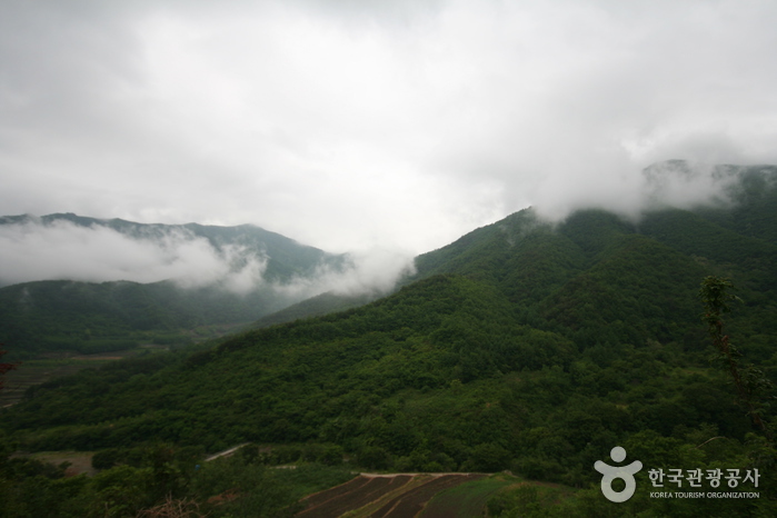
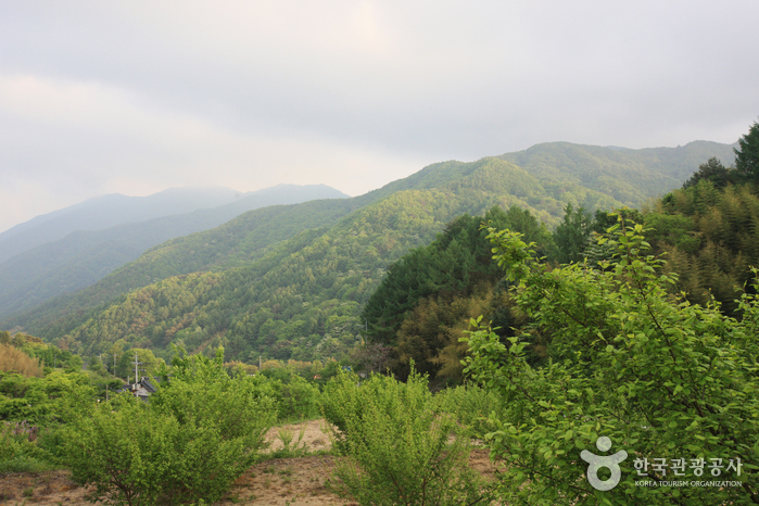
Along with Geumgangsan Mountain and Hallasan Mountain, Jirisan Mountain is known to be one of the most sacred mountains in Korea. It was named "Jiri" because it was believed to be a place that turns the innocent into the wise. On December 29, 1967 Jirisan National Park was declared the nation’s first and biggest national park. Its 440.517 square kilometer area covers Hadong, Sancheon and Hamyang in Gyeongsangnam-do; Gurye in Jeollanam-do ; and Namwon in Jeollabuk-do region. The total area is seven times that of Gyeryongsan National Park and 52 times that of all of Yeouido Island in Seoul.
At 1,915.4 meters high, Cheonwangbong Peak is the second highest peak in Jirisan National Park. Countless valleys and waterfalls surround the peak, as well as trails connecting to other peaks within the park.
Jirisan National Park (Sancheong) (지리산국립공원(산청))
295.5M 2025-03-28
320-2 Jirisan-daero, Sicheon-myeon, Sancheong-gun, Gyeongsangnam-do
+82-55-970-1000
* Please be advised that this is located in one of the areas affected by the recent wildfire (as of March 27, 2025).
** For real-time wildfire information and emergency upates, visit the Korea Forestfire Information website and the National Disaster and Safety Portal.
Jirisan National Park is the first national park established in South Korea, featuring peaks like Cheonwangbong Peak (1,915m), Banyabong Peak, and Nogodan Peak, which rank as the next highest after Halla Mountain. It's a popular destination for mountain enthusiasts, offering beautiful natural landscapes such as Naewonsagyegok Valley. The park also provides convenient facilities like Jirisan Recreational Forest, Naewonsa Temple, mountain lodges, campgrounds, and pensions.
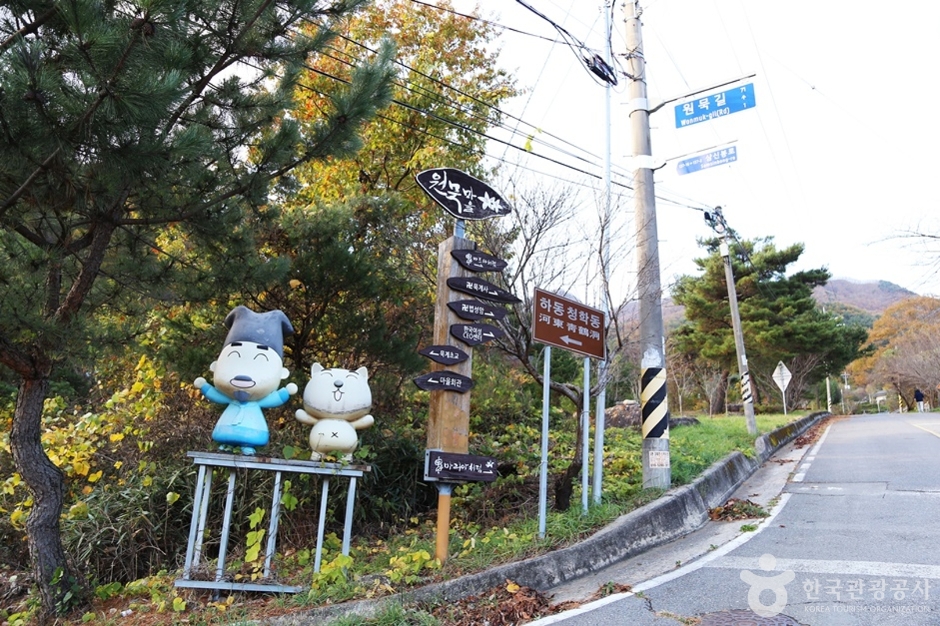
Cheonghak-dong Etiquette School Seonbi Seodang (청학동예절학교 선비서당)
6.5Km 2024-03-04
60-10 Wonmuk-gil, Cheongam-myeon, Hadong-gun, Gyeongsangnam-do
Cheonghak-dong, located at the foot of the ridge facing Hadong on Jirisan Mountain, is a village inhabited by 200 residents from thirty families. It hosts several seodangs (village schools), among which Seonbi Seodang stands out for its educational programs focusing on etiquette, character development, and Chinese characters. Additionally, the village offers a variety of experience programs, including traditional culture, farming activities, and perseverance training.
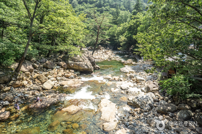
Jirisan Chilseongyegok Valley (칠선계곡(지리산))
7.0Km 2022-07-29
Chuseong-ri, Hamnyang-gun, Gyeongsangnam-do
+82-55-970-1000
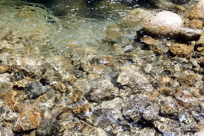
Chilseongyegok Valley is the most beautiful valley in Jirisan Mountain, and is one of the top three valleys in the nation, along with Cheonbuldonggyegok Valley in Seoraksan Mountain and Tamnagyegok Valley in Hallasan Mountain. The 16-kilometer valley stretching from Uitan of Macheon-myeon to Cheonwangbong Peak is characterized by very tough topography but beautiful scenery and is the only remaining primeval forest of Jirisan Mountain. It is also dotted with seven waterfalls and 33 ponds. The hike becomes more difficult as the trail enters the valley. Because the valley has taken many lives, some people call it "The Valley of Death." For that reason, visitors must apply in advance and hike with a guide. The trail in Chilseon Valley is a 9.4-kilometer course from Chuseong Village in Macheon-myeon to Cheonwangbong Peak, which does not follow the natural valley, due to the valley's steep and dangerous features. Starting from Chuseong Village, the trail passes Yongso Pond, Jujiteo Site, Chuseongmang Rock, Seonnyeotang Pond, Ongnyeotang Pond, Biseondam, Chilseonpokpo Falls, Daeryukpokpo Falls, Samcheungpokpo Falls and Mapokpo Falls, all before reaching Cheonwangbong Peak.
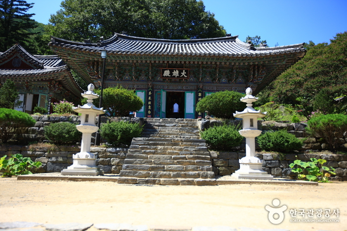
Sancheong Daewonsa Temple (대원사(산청))
7.7Km 2021-08-13
453, Pyeongchonyupyeong-ro, Sancheong-gun, Gyeongsangnam-do
+82-55-972-8068
Located at the eastern foot of Jirisan Mountain, Daewonsa Temple was first built in 548 during the Silla dynasty, but it remained closed for over thousand years until it was renovated and made bigger with the name Daewon. Unfortunately, the entire premises were lost to a big fire during the night of January 12, 1914, and all the halls and pavilions, including Yosachae, totaling 184 rooms in 12 buildings, were rebuilt in 1917. However, they were damaged once again during the Korean War and were abandoned until the war ended where the temple was rejuvenated and made even bigger. Located nearby are Geoyeonjeong and Gunjajeong Halls that are believed to have been the studying venue of scholars.
* Daewonsa Valley
The two-kilometer-long valley that stretches from the parking lot at the entrance to Daewon Temple to the temple itself is surrounded by high hills and curious-looking rocks. The clean water that oozes out through craters between the rocks generates unusual scenery. Associated with Yongso Pond is the legend that a dragon lived in it for hundreds of years before it finally flew away. Somakgol Valley is known to be the place where the last king of Garak Kingdom came to feed his cows and horses.
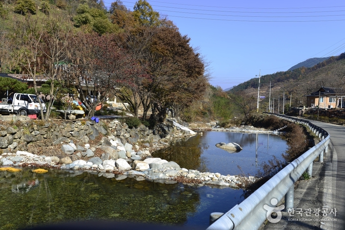
Daewonsagyegok Valley (대원사계곡)
8.0Km 2021-02-24
Samjang-myeon, Sancheong-gun, Gyeongsangnam-do
+82-55-970-7201
Daewonsagyegok Valley is a place where one can be appreciate nature's musical harmony of stream water, wind brushing against the leaves, and the chirping of birds. The nearly 12-kilometer-long Daewonsagyegok Valley's stream water originates from the highest peak of Jirisan Mountain called Cheonwangbong Peak, and flows through Jungbong and Habong Peaks, as well as Ssukbatjae Pass, Saejae Pass, Wangdeungjae Pass, Bammeorijae Pass, and Ungseokbong Peak. Before reaching the valley, the water joins the currents from Sinbatgol, Jogaegol, and Bambatgol Valleys. The volume of water increases as it passes Saejae and Oegok Village and reaches Yupyeong-ri where Daewonsa Temple is located. The incessant sound of running water fills the silence of the forest as if Buddhist nuns were chanting blessings.
Samseonggung (삼성궁)
8.2Km 2024-02-21
86-15 Samseonggung-gil, Cheongam-myeon, Hadong-gun, Gyeongsangnam-do
Samseonggung is a Taoist shrine located at 850 meters above sea level on Jirisan Mountain. It serves as a spiritual hub for practicing Sinseondo, embodying traditional Korean culture. In 1983, Kang Min-ju (Taoist Priest Hanpul), along with his disciples, restored the sodo, a sacred altar from the Gojoseon period. This shrine stands as a revered sanctuary, honoring the primal ancestors of the Korean people: Hwanin (Lord of Heaven), Hwanung (Supreme Divine Regent), and Dangun (legendary founder of Gojoseon).
Goundonggyegok Valley (고운동계곡)
8.2Km 2025-03-28
Bancheon-ro, Sicheon-myeon, Sancheong-gun, Gyeongsangnam-do
* Please be advised that this is located in one of the areas affected by the recent wildfire (as of March 27, 2025).
** For real-time wildfire information and emergency upates, visit the Korea Forestfire Information website and the National Disaster and Safety Portal.
Goundonggyegok Valley, nestled within Jirisan Mountain, is renowned for its extraordinary beauty. It also has historical significance as a resting place for the esteemed Confucian scholar Choe Chiwon during his journeys around the mountain. Characterized by crystal-clear waters and dense forests, the valley boasts a breathtaking landscape. In the summer, it becomes a sought-after destination for those seeking respite from the heat, while in autumn, its celebrated vibrant foliage draws numerous visitors.
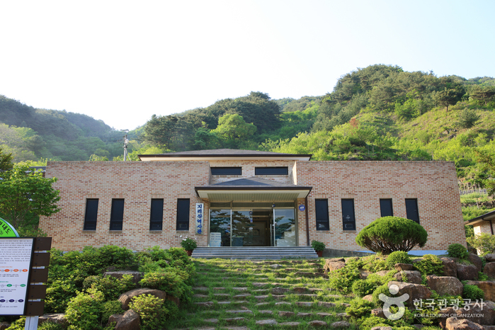
Jirisan History Museum (지리산역사관)
9.2Km 2021-06-15
1438, Hwagae-ro, Hadong-gun, Gyeongsangnam-do
+82-55-880-2954
Jirisan History Museum is located within Jirisan National Park at the start of the hiking course to Byeoksoryeong Pass. Rather a small museum, it provides detailed information about the history of North Korean partisans and the routes that they took throughout the mountain during the Korean War. The museum also exhibits the war relics, lifestyle of the mountain villagers and local produce of Hadong.
Jirisan National Park (Hadong Section) (지리산국립공원(하동))
10.1Km 2021-06-24
Hwagae-ro, Hadong-gun, Gyeongsangnam-do
+82-55-883-1750
Designated as the first national park in Korea on December 29, 1967, Jirisan National Park stretches out over 483.022 square kilometers, making it the largest national park among all 22 national parks. It covers Korea’s three southernmost provinces; Gyeongsangnam-do, Jeollanam-do, and Jeollabuk-do, one city, four counties, and 15 districts of eup and myeon. The area in Gyeongsangnam-do has many temples including Ssanggyesa Temple and Chilbulsa Temple, as well as valleys, falls, and other tourism resources.
 English
 한국어
한국어 日本語
日本語 中文(简体)
 Deutsch
 Français
 Español
 Русский