![Elephant Rock [Ulleungdo-Dokdo National Geopark] (코끼리바위 (울릉도, 독도 국가지질공원))](http://tong.visitkorea.or.kr/cms/resource/79/2499379_image2_1.jpg)
Elephant Rock [Ulleungdo-Dokdo National Geopark] (코끼리바위 (울릉도, 독도 국가지질공원))
5.5 Km 11214 2024-02-23
Hyeonpo-ri, Buk-myeon, Ulleung-gun, Gyeongsangbuk-do
+82-54-790-6182
Elephant Rock is situated approximately 500 meters off the northern coast of Ulleungdo Island and rises to a x_height of 50 meters. It derives its name from its remarkable resemblance to an elephant. This distinctive formation resulted from lava solidifying after a volcanic eruption, with the unique gap between what appears to be the elephant's trunk and its body sculpted over time by the relentless action of the waves.
Taeha Coastal Trail and Daepunggam Cliff (태하 해안산책로 및 대풍감 (울릉도, 독도 국가지질공원))
5.9 Km 0 2024-03-29
Taeha-ri, Seo-myeon, Ulleung-gun, Gyeongsangbuk-do
Taeha Coastal Trail can be reached by crossing the pedastrian bridge next to Hwangtogul Cave. While crossing the bridge, visitors can enjoy murals of Taeha Village and a photo zone. Taeha Coastal Trail is made up of trachyte and agglomerate rocks, and boasts beautiful coastal scenery due to the unique topography eroded by the wind. It is also where one can observe tafoni, a honeycomb-shaped rocks that weathered by the reaction of salts contained in sea breezes.
By taking the Taeha Hyangmok Tour Monorail for about 6 minutes and walking along the trail for about 20 minutes, visitors will reach Ulleungdo Lighthouse (Taeha Lighthouse) and the Hyangmok Geo Skywalk.
Junipers in Daepunggam Cliff grew in weathered soil formed in the cracks of columnar joints, creating a unique ecological environment isolated from inland areas for a very long time. Due to its significance, Junipers were designated as natural monuments.

Jugam Pebble Beach [National Geopark] (죽암 몽돌해안 (울릉도, 독도 국가지질공원))
6.0 Km 9205 2022-08-03
3140 , Ulleungsunhwan-ro, Ulleung-gun, Gyeongsangbuk-do
+82-54-790-6394
Jugam Pebble Beach, located on Ulleungdo Island, is approximatly 500 meters long and 20 meters wide and has round pebbles weathered by the fierce waves. The rough rock and basalt are swept back and forth by strong waves, creating round pebbles.
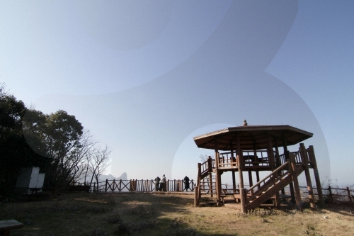
Seokpo Observatory (석포전망대)
6.7 Km 6107 2020-03-24
Cheonbu-ri, Ulleung-gun, Gyeongsangbuk-do
+82-54-790-6392
Seokpo Observatory is located in Seokpo village, a small fishing town at the northernmost point of Buk-myeon on Ulleungdo Island.
Ulleungdo Island has three popular scenic lookouts, one of which is Seokpo Observatory to the north. Created in 1905, the observatory was used by the Japanese through 1945 to monitor movements of Russian warships.
Seokpo Observatory offers views of the East Sea between Ulleungdo and the Korean Peninsula. The observatory has an 8-sided pavilion with lookout deck and telescope from which views of picturesque Jukdo and the majestic coastline of Buk-myeon are available. The area is also nearby the 3 popular attractions of Gongam (an elephant-shaped rock), Gwaneumdo, and Samseonam. Below the observatory is Seokpo Resting Area and a trekking course connecting Seokpo Observatory and Naesujeon Sunrise Observatory.
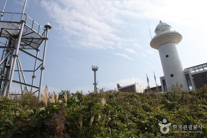
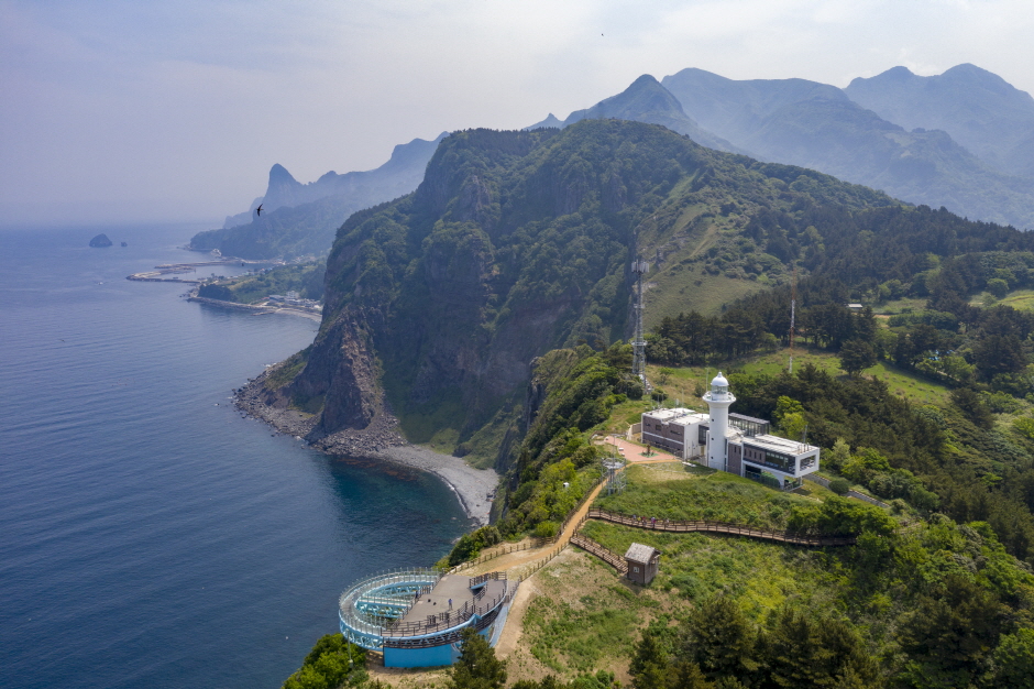
Ulleungdo Lighthouse (울릉도 등대 (태하등대))
6.7 Km 18822 2022-09-08
188, Taehadeungdae-gil, Ulleung-gun, Gyeongsangbuk-do
+82-54-791-5334
Ulleungdo Lighthouse, sometimes called Taeha Lighthouse, was first lit in 1958 as a guiding light for boats coming to and from Ulleungdo Island. The lighthouse is a round, white concrete structure rising 7.6 meters high. With a new prisim light placed in 2003, the lighthouse can reach as far as 50 kilometers away. The hiking trail up to the lighthouse is a natural, narrow path among groves of trees. The gentle slope is surrounded by uniquely shaped cliffs, so it is a popular hiking course for tourists.
![Samseonam Rocks [National Geopark] (삼선암 (울릉도, 독도 국가지질공원))](http://tong.visitkorea.or.kr/cms/resource/77/2745577_image2_1.jpg)
Samseonam Rocks [National Geopark] (삼선암 (울릉도, 독도 국가지질공원))
8.0 Km 0 2023-10-10
Cheonbu-ri, Buk-myeon, Ulleung-gun, Gyeongsangbuk-do
Samseonam Rocks is comprised of three rock pillars off the northern coast of beautiful Ulleungdo Island. The sea stacks were formed by waves breaking down a block of columner joints over time, leaving the three remaing stacks behind. The sides of the stacks are dotted with many holes, resembling honeycomb. The rocks name, meaning "Three Hevenly Maiden Rocks," comes from a myth that three heavenly maidens were so enraptured by the beauty of Ulleungdo that they missed their curfew to return to heaven and were thereby punished by being turned to stone.
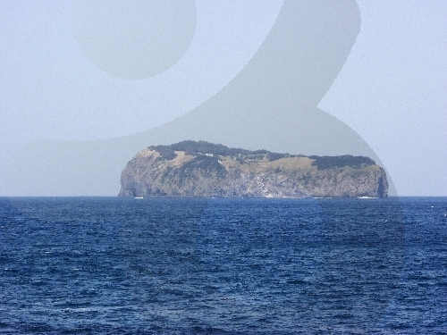
Ulleung Jukdo Island (죽도(울릉))
8.1 Km 28016 2021-07-30
59-9, Jukdo-gil, Ulleung-gun, Gyeongsangbuk-do
+82-54-790-6454
Jukdo Island is a small inhabited island near Ulleungdo Island, located 4 kilometers apart from Jeodonghang Port and 7 kilometers away from Dodonghang Port, both of which are nestled northeast of Ulleungdo Island. Normally, tourists visit Jukdo Island on their way back to the 'mainland' by taking a ferry service that departs from Dodonghang Port.
The natural environment of Jukdo Island is uncontaminated, thus almost everything is so pristine to the extent that people can even collect rainwater to drink, much thanks to its geological and cultural distance from the more modernized parts of Korea.
Gwaneumdo Island (관음도)
8.1 Km 0 2024-03-29
Cheonbu-ri, Buk-myeon, Ulleung-gun, Gyeongsangbuk-do
Gwaneumdo Island is the third largest island among the islands around Ulleungdo Island. Gwaneumdo Island was originally connected to Ulleungdo Island, but as a result of being eroded by the sea for a long time, it separated from Ulleungdo Island. There is a suspension bridge between the two islands, so visitors can travel on foot. Gwaneumdo Island has three observatories and two trails (Courses A and B), allowing one to enjoy the scenic highlights of Ulleungdo Island. Also worth seeing are the coastal cliffs of Gwaneumssanggul Twin Caves and the columnar joints that appeared due to cooling lava flows. The scenery with the various seasonal plants is spectacular. Strong winds can cause access restrictions, so it's best to check the Ulleung-gun county government office's website before visiting.
 English
 한국어
한국어 日本語
日本語 中文(简体)
 Deutsch
 Français
 Español
 Русский